This week, let’s start from Yadoriki 寄 again. We’ve been Yadoriki Forest of Growing 成長の森 in my posts last June. That place was one of the water source forests for Nakatsu River 中津川. Northwestern mountains of Kanagawa Prefecture are covered by water source forests. The place is the origin for Sagami 相模川 and Sakawa 酒匂川 Rivers. The cities in eastern Kanagawa, such as Yokohama, rely on the area for our H2O taken from these rivers. On the other hand, the water source places in northwestern Kanagawa draw water directly (and obviously) from the source. In Yadoriki, the forests surrounding the community are the source for Nakatsu River that is a tributary of Sakawa River. The northern watershed of the area is a ridge running east-west through the peak of Mt. Nabewari 鍋割山 (ASL 1272m). South of the ridge is where Nakatsu River originates, and the north is the water source for the streams pouring to Lake Tanzawa 丹沢湖. (We go there soon.) Another ridge to the peak of Mt. Nabewari goes from the south which is a kind of border between Yadoriki community and Mikurube community 三廻部. The west slope of the north-south ridge of Nabewari is for the water source forests of Nakatsu River. The east slope is the forests for Shijuhasse River 四十八瀬川 that is another tributary for Sakawa River. In Japanese “shijuhasse“ means “48 rapids.” We can expect the valley for Shijuhasse River is steep and narrow. Today’s and next week’s itinerary is to visit the water source forests for Nakatsu River and Shijuhasse River. The area is designated as Omote Tanzawa Citizen Forest of Kanagawa 表丹沢県民の森 where the ridge way from the south to Mt. Nabewari is actually a hiking course to the peak. Oh, by the way, in Kanagawa, there is another Nakatsu River 中津川 starting near Gomayashiki Spring 護摩屋敷の水 of Yabitsu Pass ヤビツ峠 we visited in my November’s post last year. That Nakatsu River is larger pouring into and out of Miyagase Dam 宮ケ瀬ダム. It then joins Sagami River at the north of Odakyu Honatsugi Station 本厚木, just before Sagami Water Intake Facility 相模取水施設 of Kanagawa Water Supply Authority 神奈川県内広域水道企業団.
<Visiting
Water Source Forests via Omote Tanzawa Citizen Forest>
Odakyu
Shin-matsuda Station / JR Matsuda Station è
With Fujikyu-Shonan Bus to Yadoriki Terminal Stop (ASL
280m) è
Japanese
Allspice Garden in Yadoriki è
Mikurube
Forestry Road (via ASL 550m point) è
The gate
for Omote Tanzawa Citizen Forest (ASL 500m) è
Black
Dragon Water Fall (ASL 450m) è
Nishiyama
Forestry Road è
Okura
Bus Terminal (ASL 290m) è
With
Kanachu Bus to Odakyu Shibusawa Station
Total walking distance: 8km, Difference in Elevation: approx. 250m
First, we take bus to Yadoriki. We get off Odakyu Odawara Line 小田急小田原線 at Shin-Matsuda Station 新松田駅, or JR Matsuda Station 松田駅 of Gotemba Line 御殿場線. From #3 stop in the bus terminal at the north exit of Odakyu, ride a commuter bus service for about half an hour by Fujikyu-Shonan Bus 富士急湘南バス (Time table here). When we visited the Forest of Growing last spring, from Yadoriki terminal we took the left road along the Nakatsu River. This time, from the bus stop, we return a bit along the bus route, and turn left at the corner of Yadoriki Post Office. There, we can find a sign saying “Mt. Nabewari / Japanese Allspice Garden ロウバイ園, this way.” Simply following the direction of the sign and in less than 10 minutes we meet a garden of thousands of Japanese allspice (Chimonanthus praecox). In 2006, the kids of Yadoriki Junior High and local volunteers planted the first batch of the seedlings, and now they are matured and increase their number naturally. Their ethereal yellow waxy flowers have noble scent. Between mid-January and mid-February every year, they are in full-bloom. This is a popular tourism destination … I’ve heard a rumor as it becomes too popular many city folks rudely poke in and take photos of the private housings around the garden. If you visit Yadoriki to enjoy flowers of Japanese allspice, please behave reasonably and respect the privacy of the locals …
 |
| Yadoriki
Bus Terminal. For today’s itinerary this is one of the last points you can use western style flush toilets before reaching to Okura Bus Terminal. Please use your chance wisely. |
 |
| We took the left road to Yadoriki Forest last Spring … |
 |
| A
review: it’s Nakatsu River we can find near Yadoriki Bus Terminal. It collects water pouring out from the underground of the Yadoriki Forest of Growing and the southwest slope of Mt. Nabewari. |
 |
| This time, we return a bit along the bus road. |
 |
| Then,
we can find a sign saying “Mt. Nabewari / Japanese Allspice Garden, this way.” |
 |
| From
the first sigh, we are welcomed by this 2nd sign showing us the direction. |
 |
| The
road to the Garden climbs slowly within tea estates. On the right, we can admire Mt. Shidango (ASL 758m) シダンゴ山. This utility route bumps to the entrance of the garden and continues to the south. To enjoy the allspices, we have to bid a farewell to the paved way and enter the garden on the front and left. |
 |
| The
Japanese Allspice Garden of Yadoriki. Actually, its walking path is populated rich variety of wild grasses. For aficionados, this is a fun place even without the flower of wintersweet. |
 |
| And
here in the Garden comes the very last flush toilets for today before Okura. The ultimate chance! |
Zig-zagging up the path in the Garden, we eventually reaches to a cedar forest planted some 70 years ago by landlords in Yadoriki after the World War II. They are now large enough to be harvested, but probably stay there as it’s too cheap to cover the cost of cutting … Among the cedars, there are several large, and probably hundreds years old, broad-leaved trees such as Cornus controversa and Ginkgo biloba. I imagined a scenery here 90 years ago … The place could be a grassland where people of Yadoriki harvested the grass for thatching, or firewood forest with a bit of remaining huge wild trees … With the Great Kanto Earthquake of 1923 関東大震災, Yadoriki suffered massive landslides and many houses were swallowed by the rocks and debris from the mountains. Grassland, overused firewood forest, and /or aggressive logging by Morimura-gumi Co. 森村組 (now NoritakeCo.) on gravelly soil of Tanzawa may have made the area vulnerable for such natural incidences … A thriving Japanese allspice garden and cedars would be a measure for preventing such tragedy from returning … I really hope the trees would hold lots of water underneath.
 |
| In
autumn, Japanese allspices in Yadoriki produce lots of seeds for their next generation. |
 |
| Always follow the direction to “Mt. Nabewari.” |
 |
| The route goes through alternating coniferous forests, |
 |
| Tea estates, and |
 |
| Broad-leaved
forests that would be once for firewood. We can find remnants of coppicing here and there. |
 |
| And of
course, deer fence. You’d better prepare for Haemadipsa zeylanica japonicaduring your visit here between May and November. Lots of deer = lots of blood sucking leeches. |
 |
| In the
floor of coniferous forests in Tanzawa, we can find Asarum nipponicumthat is endemic species of Japan. It flowers very peculiarly. Could you figure out its flower in this photo? |
According to Mr. Misao Ozawa 小沢操, the last managing director of the Kanagawa Forestry Authority かながわ森林づくり公社専務理事 that was dissolved in 2010, after deep-seated landslides of the Great Kanto Earthquake, the prefectural government invested in reconstruction of the area for 1923-1930. The prefectural government invited forestry engineers from all over Japan to take charge in the frontline of the project. The work covered 1913ha out of collapsed 8632ha, and created the basis for later forest management. For such deep and steep mountains not much mechanized technology was available then. Almost all the work was done by hand using the obtainable materials in the field, like rocks, gravels, and logs. The collapsed slopes were step-processed with small waterways, and each step was planted with locally procured Alnus firma and Punus thunbergii. Even though, due to lots of typhoons and indiscriminate logging during and immediately after the World War II, the restorative works did not go smoothly. Then in 1949, the prefecture began to approach forest management in a coherent way for water source procurement. Their change of attitude started 5-year plan in 1960 for erosion control works. The fragile bold mountains were gradually afforested with commercial coniferous trees. Unfortunately, the policy did not have much consideration for the ecosystem of the area. From the late 1970s, people started to observe the die-back of natural beeches and Abies firma near the peaks of Tanzawa mountains, and ubiquitous deer ate up the undergrowth. The rest of the story was what I told during my July posts for deer problems in Tanzawa. The area received emergency treatments to preserve water source forests. In 2006, for securing a sustainable management of Tanzawa mountains, it was established a collaboration mechanism among local governments, academia, industries, media, and civil society, which was named the Committee for Nature Restoration in Tanzawa-Oyama Area 丹沢大山再生委員会. They coordinate management of water source forests in Tanzawa by various actors including forest volunteers. This is a project whose result would become apparent in hundreds years’ time. We have to be patient …
 |
| Yeah. This place requires more work to be done … |
 |
| Mini-Cappadocia
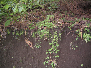
here; meaning, soil erosion is occurring … |
Woops,
we have come this far already. Next week, I tell you the continuing adventure
of mine through the water source forests for Shijuhasse Rivers (and a bit for
Mizunashi River 水無川). Stay tuned!
Kanagawa
Water Source Authority
1194
Yasashi-cho, Asahi-ku, Yokohama, 241-8525
Phone:
045-363-1111


No comments:
Post a Comment