
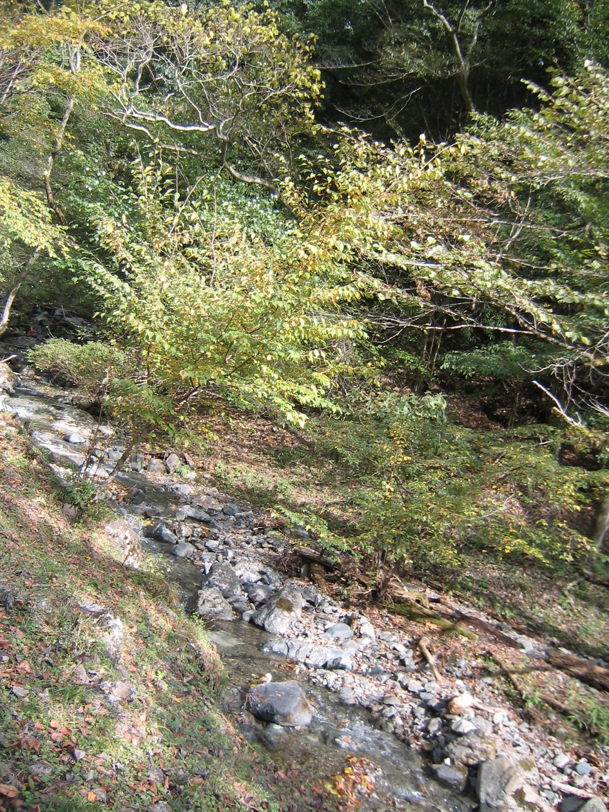
From Yadoriki Japanese Allspice Garden 寄ロウバイ園 we climb up the trekking road within the afforested coniferous trees to about ASL 550m. Then, we eventually comes to a crossing with the paved Mikurube Forestry Road 三廻部林道. To the left, we can go to Miroku Camp Field ミロクキャンプ場 near Yadoriki Forests of Growing やどりき成長の森. Going straight into a narrow trekking route in front, we enter one of the hiking courses to the peak of Mt. Nabewari 鍋割山 (ASL 1272m), of some 3 hours steep and continuous climbing. Today, we take to the right paved road, which goes down to the picnic field of Omote Tanzawa Citizen Forest 表丹沢県民の森. This area is the water source for Shijuhasse River 四十八瀬川, i.e., we’ve crossed the water shed. The north side slope of the route is mainly consisted of broad-leaved natural forests, and the south-side is alternating afforested coniferous trees and natural broad-leaved trees. This route goes through very rich vegetation where my senior forest instructors found “almost all the plants listed in a popular reference for the nature of Tanzawa.” It’s fun to identify each entry of a book en situ! Buuuuut, it could become dark in a deep mountain if we allow our enthusiasm to run amok. We kept our head cool, and proceeded to the gate of Mikurube Forestry Road where a utility road from Mikurube Community meets with the forestry road. From near the gate during weekends, we can find a row of cars parked along the road. We are arriving at the “picnic field” of Omote Tanzawa Citizen Forest.
 |
| The crossing with Mikurube Forestry Road |
 |
| It’s to the peak of Mt. Nabewari. |
 |
| Along
Mikurube Forestry Road to Omote Tanzawa Citizen Forest in early October, we can find lots of lots of berries of wild Japanese pepper. I personally love their extremely picante taste. |
 |
| Chrysanthemum japonicum |
 |
| The
route is like this. Nice, isn’t it? |
 |
| There
are also trees of Actinidia arguta, the ancestor of kiwi. |
 |
| The Mikurube Forestry Road ends here. |
 |
| Near the picnic field |
 |
| The
map of Omote Tanzawa Citizen Forest. As we can see here, Mikurube Forestry Road goes through a part of the Citizen Forest. |
Omote Tanzawa Citizen Forest is popular destination for family hikers. The northern most area of the Forest has about ASL 700m, and the place we have arrived now is approx. ASL 500m. Hiking only within the Citizen Forest can be substantial enough for new comers to Tanzawa. As we have experienced along Mikurube Forestry Road, the nature of this place is very rich. This is the water source forest for Shijuhasse River, a tributary of Sakawa River 酒匂川. At the entrance for the picnic field, there is a large wild Japanese horse-chestnut tree on the right. On the left slope, during fall, we can find a colony of Gentiana scabra var.burgeri which opens their flower in a sunny autumn day. This flower was once ubiquitous in Japan even in backyards of houses in Tokyo. They became the motif for coat of arms 竜胆紋(龍胆紋) for the oldest Samurai family, Genji clan 源氏. Now we have to come this far into a water source forest to admire them … sad. Turning left here to enter the picnic field, we can see a log hut over there that is a famous toilet. Why famous? Er, it has a good exterior as a toilet, and the facility itself is … holes and a septic tank beneath. When I’ve been there twice, there was no paper. You can use it if you must …
 |
| Japanese
horse-chestnut, aka Japanese “marronnier,” had already turned the color of their leaves in early October. |
 |
| Picnic
field has a gazebo and picnic benches dotted in the area ... You can sit on the lawn, but I suspect vampire leeches there can wait for us. You can try. |
 |
| Hi
there! Lovely Gentiana scabra var.burgeri. |
 |
| Toilet! |
 |
| Inside
of the forest has lots of sign posts like this. Trekking road within the Citizen Forest has a name according to notable tree along a route, like “the way of the forest of Lidera praecox.” |
Passing the entrance to the picnic field, there is a gate in the paved road. Beyond this point is a graveled road only for hikers and permit-holding cars. It eventually meets with Nishiyama Forestry Road 西山林道 that is the main hiking route to the peak of Mt. Nabewari (and Mt. To 塔ノ岳, ASL 1491m). Today, we take a shortcut to Nishiyama Forestry Road from the picnic field. There is a trekking road from the Japanese horse-chestnut. It goes down zig-zag to Shijuhasse River, some 100m below. Over the river, or I would say a mountain stream, there is a small wooden bridge. We cross it one-by-one, and the road turns left to start climbing inevitably. But before going up, let’s go straight in a narrow way in front of us running along a small stream pouring to Shijuhasse River. We can see a waterfall over there. It’s 15m high Black Dragon Waterfall 黒竜ノ滝. Some 150 years ago, there was a hut beside this waterfall where a popular shaman, called Black Dragon, lived. He had lots of admiring customers, but there is nothing now. Legend says one typhoon and a landslide crushed his dwelling. Another rumor explains he allowed a woman to stay in his place although women were not allowed to enter the area. His transgression roused ire within Yamabushi community 山伏 who set fire to his place. I found the available place under the fall is too small to have a human dwelling to be torched even if it was tiny. The landslide theory would be closer to the fact … then, the womanizing scandal? It says something about the society a century ago … jealousy for a celebrity, difficulty in celibacy, the status of Japanese women …
 |
| Near
the Japanese horse-chestnut, there is this sign at the entrance to the trekking road going down. |
 |
| It descends steeply to … |
 |
| Shijuhasse
River. We proceed a bit along the river and |
 |
| Find a wooden bridge. Let’s cross it! |
 |
| A view
of upstream of Shijuhasse River from the bridge. It should have 48 ravines. |
 |
| Take a
small way straight along this stream to … |
 |
| Black Dragon Waterfall. |
 |
| Returning to the shortcut to Nishiyama Forestry Road |
Sharply going up from the riverbank of Shijuhasse, we reach to Nishiyama Forestry Road. This route comes from populous Okura community 大倉 where Hadano City 秦野市 has several information centers for alpine activities in Tanzawa-Oyama Quasi-National Park 丹沢大山国定公園. The area continues to be water source forests for Shijuhasse River, but comparing with Mikurube Forestry Road the vegetation surrounding Nishiyama Forestry Road is more of afforested coniferous trees. For one thing, the slope where Nishiyama Road runs is less steep so that it would be easier for humans to do commercial forestry. It also means, the place is more accessible for deer. Sure enough, we witnessed rows of Boehmeria spicata whose tips were eaten by deer at about 70cm high. It seems to me the afforested area here received thinning some time ago … OK, we are in a national park where commercial harvesting of logs is not a simple job bureaucratically. Many logs must have been left there, neatly at least at that time, expected to act as bracing for the soil underneath. The light is coming in to some spots of the forests. Though, the forest floor of cedars sometimes has a limited variety of plants such as Oplismenus undulatifolius and Daphne pseudomezereum both of which are hated by deer. Otherwise, some collapsing logs started to be washed away by torrents running down the surface of the mountain when it rains … I a kind of understood the raison d’être for the Committee for Nature Restoration in Tanzawa-Oyama Area 丹沢大山再生委員会. We need more work here …
 |
| We’ve reached to Nishiyama Forestry Road! |
 |
| Shijuhasse River seen from Nishiyama Forestry Road |
 |
| In
Nishiyama Road, we often have to cross a very shallow stream without bridge. It’s a kind of clever road maintenance as the area is famous for mini-flush floods from numerous small streams when it rains. Rather than digging water ways and building a bridge (even small one), letting the water flow naturally can stabilize the mountain more effectively and economically. |
 |
| Yes,
the forest floor receives light … but Oplismenus undulatifoliusdominates the place … |
 |
| I think we can do something here … |
 |
| Even
though, we enjoy the variety of wild plants along Nishiyama Road. It’s a colony of Aconitum… aka flower for Hekate. No wonder deer don’t eat them. |
Nishiyama Forestry Road is an active road during weekends as many hikers take this route to the main mountain ranges of Tanzawa. The gate of the road is situated just outside of the boundary for the national park. From there, follow the direction saying “Okura Bus Terminal, this way.” Soon we enter an agricultural community of Okura 大倉. The farmers leave their freshly harvested produce in tiny shelves dotted along the way. “A head of (large) cabbage, 100 yen.” “A bag of potato, 100 yen.” “A bag of carrots, 100 yen.” … You’ve got the idea, haven’t you? Bring 100 yen coins and your shopping bag to utilize the opportunity! Okura Bus Terminal 大倉バス停 is a very busy place. Especially between 15:00 and 17:00, the hikers from popular peaks of Tanzawa congregate here to catch a bus to Odakyu Shibusawa Station 小田急渋沢駅. Be ready to wait for your turn for at least 30 minutes. Don’t’ worry. They have more than 30 services a day to the Station. If you think you can skip 1 or two more buses, you may stroll in the park to the east of the bus terminal. It’s the entrance to Hadano Tokawa Park 秦野戸川公園 with its famous Wind Suspension Bridge 風の吊り橋 over Mizunashi River 水無川 originating from Mt. To. It’s a tributary of Hanamizu River 花水川 that pours into Sagami Bay 相模湾 at the border between Hiratsuka City 平塚市 and Oiso Town 大磯町. Hadano City 秦野市 is unique in Kanagawa where lots of spring water can supply large amount of H2O to the people. “Mizunashi” in Japanese means “no water,” but actually this river runs subterranean in Hadano basin, which is the origin of the name. The spring water in Hadano City is supplied by rivers including Shijuhasse and Mizunashi. So, the scenery from Wind Suspension Bridge to the direction of Mt. To is another water source forests in Kanagawa! Oh, by the way, the toilet in Hadano Visitor Center 秦野ビジターセンター next to the bus terminal is top notch Japanese high-tech toilets with washlet and warm seat (papers, soaps, dryers, flowers …). Your patience would be finally rewarded here.
 |
| The
gate at the entrance of Nishiyama Forestry Road |
 |
| Just
outside of the gate, please do not miss this sign to the bus terminal! |
 |
| For a
while, the road is a trekking road observing Tanzawa mountains on the left. |
 |
| Then suddenly the scenery is opened for veggie fields. |
 |
| Simply follow the road meandering in Okura community, |
 |
| and over there is Okura Bus Terminal where |
 |
| lots of hikers waiting for their turn to the bus. |
 |
| Here
at the terminal, we can drop our hiking registration when we start visiting the main mountains of Tanzawa. |
 |
| Hadano Visitor Center for our best toilet experience today |
 |
| Wind Suspension Bridge |
 |
| Mizunashi
River and the front mountains of Tanzawa main mountain range |

Tanzawa-Oyama Quasi-national
Park
Hadano Visitor Center of
Kanagawa Prefecture 神奈川県立 秦野ビジターセンター
1513 Horiyamashita, Hadano,
Kanagawa, 259-1304 神奈川県秦野市堀山下1513
Phone: 0463-87-9300
No comments:
Post a Comment