We are staying in Hayama. Seeing from the Hayama Beach to the northeast, we immediately notice a hill really close to the sea. Yeah, “Hayama, where the sea and mountains meet.” The hill is what we have observed from the top of Mt. Sengen-yama between us and the sea. It is a prefectural park, called Hayama Sangaokayamaryokuchi Park 県立はやま三ヶ岡山緑地. The paths in the Sangaokayama are for pure mountain trekking. The place is not for flip-flops of beach wear, but with good walking shoes and long-sleeved shirts and pants. Its steep slopes and cliffs rapidly come down to the sea, with roads often pasted on a cliff or narrow ridgelines. Though, they are well-maintained routes. Itinerary-wise, the place is self-contained and no tricky crossing exists as we have found in Mt. Sengen-yama. If you are accustomed to mountain roads, visiting the Park can be completed in 2 hours, lunch time included. i.e, Provided you prepare well, you can combine hiking with visiting beach and fashionable cafes in one weekend from Tokyo. Let us plunge into the forest of Sangaoka. 😄
 |
| When we
see inland from Hayama Beach, the hill in front of us is Hayama Sangaokayamaryokuchi Park. |
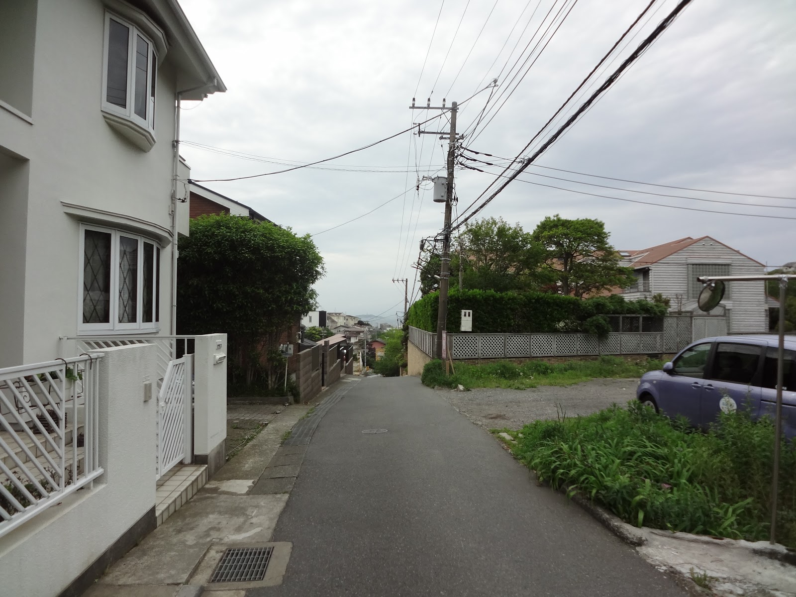
Before starting, I repeat myself since last week: please do not think you can visit Sangaoka with flip-flops and tank-tops. The peak of Sangaokayama Park, named Mt. Ohmine-yama (大峰山 ASL 143m), is on the top of cliffs. It has 3 approaches all of which have very steep steps constructed on narrow ridges. In addition, the place has rich vegetation in humid air from the sea. Except during deep winter, the forest floor of the place is a nice home for active Japanese pit vipers, or in Japanese, mamushi マムシ. The park does not have toilet or water faucets. We definitely need to be in good hiking gear to come there. Now, we are ready in our walking shoes, and there are 3 entrances to Sangaoka (a schematized map is here); to Shin’nase course 真名瀬コース, to Ajisai (Hydrangea macrophylla) course あじさいコース, and to Tsutsuji (Rhododendron) course つつじコース. I recommend to entering the forest from Shin’nace or Ajisai entrance and exit from Tsutsuji gate. Both Shin’nace and Ajisai courses first have very steep and long steps as in Mt. Sengen-yama that would be easier to manage climbing up than going down. In any case, first you take a commuter bus called “Kaigan-mawari (海岸回り Sea-Side Route)” from #2 Bus Stop in front of Keikyu Shin-Zushi Station 京急新逗子駅. They have lots of services so that you don’t have to worry time-table. All the entrances of the Sangaokayama Park can be accessible from the bus stops of Sea-side Route of the commuter bus services.

For
Ajisai Course, we get off at Morito-jinja Stop (森戸神社 Morito Shrine), and walk north for about 100m to turn right at the corner of
Starbucks. On your left is a venerable delicatessen Hayama Asahiya Beef 葉山旭屋牛肉店, and then Union Supermarket. Passing these and
going south, please turn left at the first corner after the Union Supermarket.
We proceed in a quiet residential area to turn right next at the third corner.
The road starts to gain altitude although we are still in the community of
uptown houses. Don’t be tempted to turn left or right and just keep on climbing
to the hill in front of you which is actually the Sangaoka Park. Eventually,
there will be a clinic on your right along the road. Around there, the slope
becomes more mountain-like (but completely paved) and at the end of a short
climb is another road with pedestrian crossing. Over there you’ll find a sign
saying “Entrance to Ajisai Park.” Bingo. Enter that narrow, but paved climbing
residential road which ends at the stone wall of the foot of Sangaoka Park. On
your left, we can figure out the sign “Entrance to Ajisai Route.” ¡Adelante! This entrance is a
kind of neighborhood garden with a view to Sagami Bay. In today’s itinerary,
there is only one toilet which is at this entrance. If you need, please do not
miss your chance here. Entering
the forest, the road is immediately climbing up with steep steps for about
200m. This is the route shortest to the top of Mt. Ohmine-yama of ASL 143m. If
you climb the hill in stride, it takes less than 20 minutes to the peak. As the
entrance of the course is about ASL 25m, we gain more than 100m of altitude in
20 minutes’ time.
 |
| Delicatessen Asahiya Beef |
 |
| A clinic on your right |
 |
| The sign to “Ajisai Park” |
 |
| Find that sign. It’s the entrance to Ajisai Route. |
 |
| Entering,
the road soon diverges in two. To toilet please take right. |
 |
| It
ends with a community garden with lots of Hydrangea macrophylla. The place was once for Hirayama Hotel of Hayama established in 1893. The hotel was built in a European colonial style and a base camp for vacationing expats of 100 years ago. It was there until 1978. |
 |
| From
the garden, we have a nice view of Sagami Bay 相模湾. Mmmmmmmmmmmm, spring haze covers Mt. Fuji that was supposed to be in front of us … |
 |
| Toilets, or remnant of the hotel. |
 |
| Going
back to the trekking road. All the 3 entrances of Sangaokayamaryokuchi Park have a small transparent box for us to pick up a map of the park. They also have storage for walking poles. The system is, we use one of those, and return it at another gate when we leave. |
 |
| Up, up, up … |
 |
| And
the road becomes relatively spacy mountain ridge (compared with the other ridge ways of the Park). |
 |
| And another (several) steep climbs … |
 |
| approaching
to the top of Mt. Ohmine-yama (ASL 143m). This park really has many picnic benches ... |
 |
| With a
view. We can observe Shin’nase fishing port 真名瀬漁港 down there. |
For Shin’nase
course, please get off the bus at Shin’nase Stop 真名瀬 next to
Morito-jinja Stop. Walking 50m or so to the south, on your left there is a Torii gate that was an entrance to
Kumano Shrine 熊野神社 of
Shin’nase Fishing Village. Through a narrow community road, we reach to the
sanctuary of Kumano Shrine, where on the right of the shrine building there is
a sign saying “Shin’nase Route, this way.” The route climbs up rapidly with
steep steps along a narrow ridge way. In the middle there is a metallic gate
coming up from the valley with a notice “Tsunami escape route.” Wow. People of
Hayama Town must have prepared to conquer these cliffs in backyard if emergency
happens …For about 10 to 15 minutes’ climb we reach to an open space, named
Nishimine Open Forest 西峰疎林広場, which is a beginning of more
leisurely walk on the ridge of Sangaokayama. The open space has a name plate
saying “the place is open to the public thanks to the generosity of Kajima
Family,” the founder and the largest shareholder of Kajima Co. Oh, soooooooooooooo Hayama. From the ridgeway
of Shin’nase course to the top of Mt. Ohmine-yama, we can observe Sagami Bay
and Mt. Fuji to the left, and Pacific Ocean to the right. About 200m from the Nishimine
Open Forest, there is a view point to Sagami Bay. The shape of Mt. Kintoki 金時山 is clearly
recognizable from here. In May, chic rearing birds are very busy singing along
the way. Lots of lesser cuckoos somewhere around me … in about 20 minutes or so
from the open space, we reach to the top of Mt. Ohmine-yama.
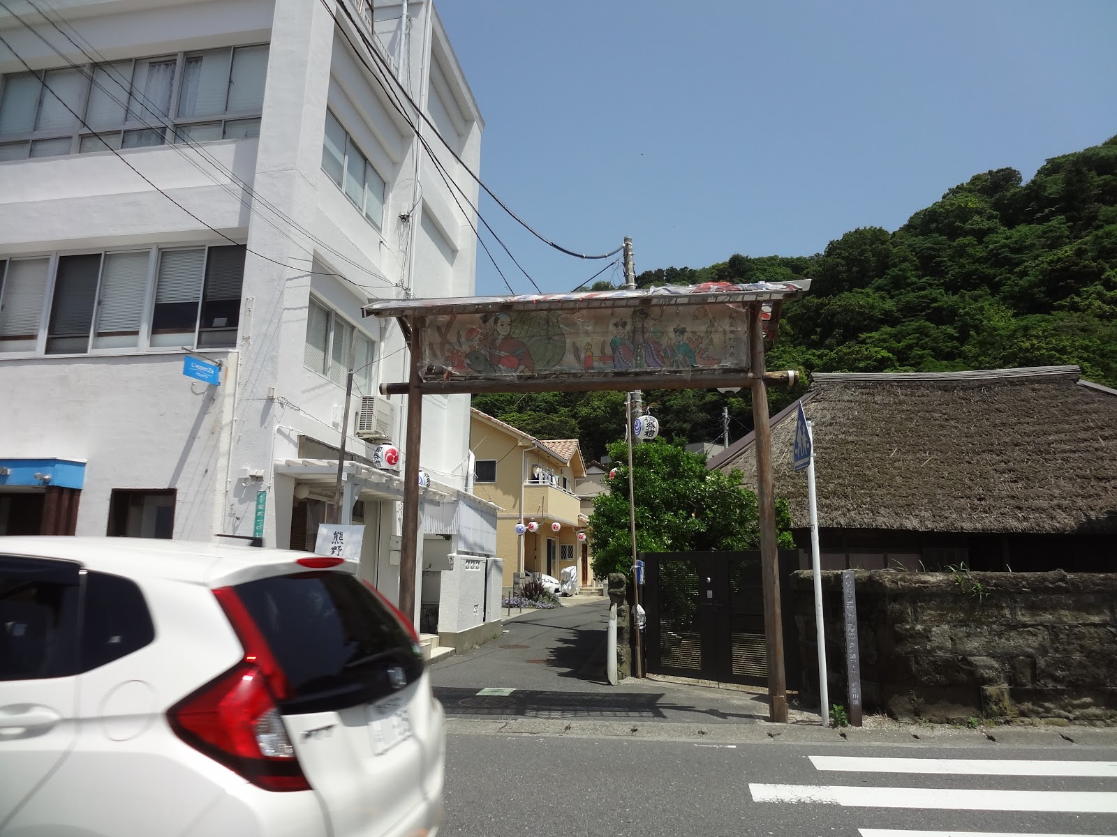 |
| The torii that we can find from the bus stop. |
 |
| At the
end of the road is Shin’nase Kumano Shrine. Every May 15th, they dedicated a special Kagura Dance 神楽 to show gratitude to the protection of the god of Kumano Gon’gen 熊野権現. |
 |
| The entrance to Shin’nase course of Sangaokayama Park |
 |
| The
escape route from tsunami for Shin’nase community people … |
 |
| This kind of steps continues for a while to |
 |
| Nishimine
Open Forest. The place also has several picnic benches. |
 |
| A
typical ridgeway of Hayama area. Both sides are tumbling down. I think this part is relatively wide. |
 |
| A view
to Sagami Bay. Spring in Kanagawa is always like this … a bit hazy even in very sunny day. Mt. Fuji should be in the center of this photo! |
 |
| And we have arrived at the peak of Mt. Ohmine-yama. |
From the top of Mt. Ohmine-yama to the foot of the hill, we now descend via Tsutsuji (Rhododendron) course. Distance-wise it is the longest in today’s itinerary, but I found the easiest as its road is not that steep nor narrow as the other two courses. The road continues leisurely with ups and downs, with a feel of deeper forest than the other two courses. I later checked to confirm that the road runs certainly a bit horizontally further from the towns down there ... but that’s not the only reason of its secludedness … The route has two more viewing points, and after the second point named Higashimine Open Space 東峰広場 it goes down steadily to the foot of the hill. The end (or beginning) of Tsutsuji course is Isshiki 一色 residential area. Just going forward in a narrow but paved road between houses, we come to the beautifully wide National Route 134 where on your right is a walled pine forest with a wide gate and a police. Yes. It’s Hayama Imperial Villa.
 |
| To Tsutsuji course from the top of Mt. Ohmine-yama, let’s simply go straight from Shin’nase course. |
 |
| In general Tsutsuji course is gentler than the other two. |
 |
| A picnic table at the first viewing point from Mt. Ohmmine-yama in Tsutsuji course. |
 |
| And the view of Sagami Bay from there … |
 |
| From
the second viewing point, the route goes down in honest. |
 |
| Almost
to the goal … all in all the forest of Sangaoka has a light-touch even if the forest itself is deep along Tsutsuji course such as here. |
 |
| A photo taken from the outside of the gate for Tsustuji course. |
 |
| Soon we come to a utility road of Isshiki Community of Hayama. |
 |
| We
come out from the road on the right of this photo. A small cake shop on the left is Hayama Lemon Tree famous for her donuts and cheese cakes. Some celebrities drive from Tokyo to bring the sweets home. |
 |
| The
nearest bus stop from Tsutsuji course gate is Kyu-Yakuba-Mae Stop 旧役場前. |
 |
| A bit
further down to the sea is Hayama Isshiki Post Office. Wow, the building looks like a café, but it’s a post office … |
 |
| And over there is Hayama Imperial Villa. |
Until 1945, from there to the current Museum of Modern Art, the Imperial Villa occupied the beach side far larger than now, and hence contributed to the wider and deeper forest in Tsutsuji course of Sangaokayama. As such, if you exit from Sangaoka Park from Tsutsuji course gate, you will meet with fashionable cafes, restaurants, or even apparel boutiques along Route 134. Bonus: take a narrow road along the wall of Imperial Villa to the sea, and before you is Hayama Isshiki Beach 葉山一色海岸. We people in Kanagwa secretly know this is the best beach in the entire Sagami Bay. Imperial Family traditionally has several marine biologists and this is their research field. Inevitably, the water is very clean, and the town ordinance controls the usage of the beach not for party of summer nudists. You can enjoy relaxing and far-quieter sun bathing during summer. If you still have time you can visit Hayama Shiosai Park 葉山しおさい公園, next to the Imperial Villa, where they preserve old Imperial buildings in which Emperor Hirohito was crowned at the time of his father’s death. Next to Shiosai Park is the Museum of Modern Art of Kanagawa Prefecture whose curators regularly organize interesting exhibitions that are certainly not for downtown Tokyo. And the view of Mt. Fuji from Isshiki Beach is (if you can see) straight from ukiyoe of Hokusai. Hayama is the town of Japanese royals, both its sea and mountain of deep but light forests.
 |
| If we
take a small alley along the Imperial Villa, we will come to |
 |
| Hayama Isshiki Beach |
 |
| The
gate to Hayama Shiosai Park. Admission: 300 yen for adult, 150 yen for kids. |
 |
| And
next to Hayama Shiosai Park is Museum of Modern Arts in Hayama. |

If you find problems in Sangaokayama of
Hayama, please make a contact to
Yugawara Town Hall 葉山町役場
Phone: 046-876-1111
www.town.hayama.lg.jp